
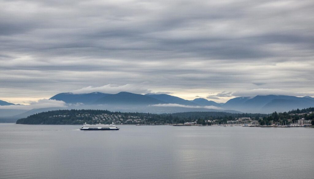
Nanaimo weather rewards patience and planning. One day the Strait of Georgia sparkles under blue skies; the next, a Pacific front blows through with sideways rain that smells like cedar. If you live here or you’re visiting, you don’t just check a forecast—you learn how the coast thinks. This guide explains weather in Nanaimo, BC with practical detail, local context, and enough specifics to help you choose the right jacket, plan a hike, or time a ferry crossing. Expect real-world tips, seasonal patterns, microclimate quirks, and the most reliable tools Canadians use to stay ahead of the elements.
Below, you’ll find monthly norms, how to read the marine forecast near Nanaimo, why the city is drier than you might guess, and what to do when an atmospheric river barrels in. You’ll also get packing advice, gardening guidance, safety notes for windstorms, and a clear picture of how climate change is already reshaping the rhythms of the central Vancouver Island coast.
Where Nanaimo’s Weather Comes From
Nanaimo sits on the east coast of Vancouver Island, looking across the Strait of Georgia toward the Coast Mountains. Geography does most of the storytelling here. Moist Pacific systems roll into British Columbia in fall and winter, crash into the Island’s spine, and wring out heavy rain on the west side. By the time those systems spill over the mountains and reach Nanaimo, much of the punch has been spent. The result: wet winters, yes—but not a rainforest downpour every single day. Summers trend dry and sunny, thanks to high pressure that settles over the Northeast Pacific.
Another key player is Mount Benson, the hulking peak that rises southwest of downtown. It shapes local winds, showers, and snowfall. Higher elevations around the mountain typically collect more snow than the waterfront, and its slopes squeeze extra drizzle out of marginal systems. Just a few kilometres can mean a different day: downtown Nanaimo gets light rain, North Nanaimo is dry, and the hills around Jingle Pot see flurries. Microclimates are not a curiosity here; they’re the rule.
Finally, the Strait acts like a giant thermal flywheel. Water holds heat far better than land. That moderates temperatures all year long—cooler afternoons during heat waves and milder nights in winter. It also introduces sea breezes in warm months and, in winter, corridors for strong outflow winds that spill from mainland inlets and the Fraser Valley into the Strait of Georgia, kicking up waves and ferry delays.
Nanaimo Climate at a Glance
Nanaimo belongs to the classic West Coast mix: mild, wet winters and warm, dry summers. If you like labels, think temperate coastal with Mediterranean-style summer dryness. The city is usually a touch cooler than Victoria in summer and a shade cooler in winter, but drier than Vancouver from late spring through early fall.
Typical winter afternoons reach the mid single digits Celsius, with nights hovering near freezing. Most winter days are frost-free by the shoreline, though cold snaps do arrive every few years with ice and snow, particularly away from the ocean and at elevation. Summer afternoons commonly land in the low to mid-20s, with cool nights and very low humidity for Canada. Heat waves happen—June 2021 put much of BC into the upper 30s and around 40°C in places—but those extremes are outliers, not the baseline.
Rain falls most often from October through March. Summer is the Island’s reward: long stretches of dry, comfortable days, gentle breezes, and sunset after 9 p.m. in June and July. Fog is a fall and winter morning companion, especially around the airport, estuaries, and low-lying neighbourhoods, with sun breaks or high cloud emerging later in the day.
What “Typical” Looks Like Month by Month
Local conditions vary by neighbourhood and elevation, and any given year can lean wetter, drier, warmer, or cooler. Still, the following table gives a useful, rounded snapshot of nanaimo weather across an average year. Use it to plan clothing, garden timing, or a trip—then check the latest forecast before you go.
| Month | Typical High (°C) | Typical Low (°C) | Precipitation (mm) | Rain/Snow Days | Daylight (hrs) |
|---|---|---|---|---|---|
| January | 5–7 | 0–2 | 120–160 | 16–20 | 8–9 |
| February | 6–8 | 0–2 | 80–120 | 13–17 | 9–10 |
| March | 9–11 | 2–4 | 70–100 | 13–17 | 11–12 |
| April | 12–14 | 4–6 | 45–70 | 9–12 | 13–14 |
| May | 16–18 | 7–9 | 35–55 | 7–10 | 15–16 |
| June | 19–22 | 10–12 | 30–45 | 5–8 | 16–16.5 |
| July | 23–25 | 12–14 | 15–30 | 3–5 | 15.5–16 |
| August | 23–25 | 12–14 | 15–35 | 3–6 | 14–15 |
| September | 18–20 | 10–12 | 35–60 | 6–9 | 12–13 |
| October | 13–15 | 6–8 | 90–130 | 12–16 | 10–11 |
| November | 8–10 | 3–5 | 140–190 | 16–20 | 8.5–9.5 |
| December | 5–7 | 0–2 | 120–160 | 16–20 | 8–8.5 |
A rule of thumb: from late spring to early fall, expect long dry spells punctuated by a few showery days. From late fall to early spring, reverse it—frequent wet days with dry breaks that reward anyone who doesn’t mind a few puddles.
Seasons in Detail
Winter in Nanaimo (December–February)
Winter is kinder here than in most of Canada, but it’s still winter. Expect grey skies, drizzle, and the occasional burst of wind that pushes ferries behind schedule. On many days, temperatures hover between 2°C and 7°C. Light frost visits interior neighbourhoods more often than the shoreline. Snow doesn’t stick around long near sea level, though it can linger for a week in shaded yards after a decent storm, and higher suburbs will hold onto it longer.
The most disruptive events are a double act: a cold outflow from the Interior followed by a moist Pacific front. First, Arctic air sneaks through mainland valleys and pours into the Strait; then a low-pressure system rides in and throws snow over top. Nanaimo can go from rain to slick snow to freezing rain in a 24-hour window. These setups are uncommon, but when they hit, they tangle commutes and ground flights. Keep an eye on Environment and Climate Change Canada (ECCC) Special Weather Statements, Snowfall Warnings, and Freezing Rain Warnings.
Winds tend to run southeast during Pacific storms, strongest over open water. On exposed headlands like Piper’s Lagoon and Neck Point, gusts turn the scene into a salt-spray theatre. Power outages are part of coastal life; BC Hydro usually restores service quickly, but a battery pack and a couple of lanterns are never a bad idea in storm season.
Spring in Nanaimo (March–May)
Spring arrives early by Canadian standards. Daffodils show up in March, and cherry blossoms follow. Rain eases back, and the sun begins to win more arguments. By May, many days feel like early summer—green hills, calm mornings, and evening colours over the Strait that go on and on.
Despite the turn, spring still throws mood swings. March and early April can produce brief hail showers or a slushy surprise at higher elevations. The best strategy is layering: a light waterproof shell, a warm mid-layer to peel off, and shoes that don’t mind puddles. Gardeners start hardening off seedlings in April; coastal microclimates keep the last frost date early—often late March to mid-April near the water—but colder pockets hang onto frost into late April. Nanaimo Airport (YCD), in Cassidy just south of the city, is typically colder at night than the waterfront and more prone to morning fog.
Summer in Nanaimo (June–August)
Summer is the Island at its most convincing. Blue sky is standard, and humidity is mercifully low. Late June through August brings afternoon highs in the low-to-mid 20s Celsius, with sea breezes that keep the edges crisp. You’ll need sunscreen, sunglasses, and a hat. UV levels run high on clear days, especially over water.
Rain is scarce and often local—quick convective showers that splatter the pavement and leave steam rising. Prolonged dry spells common to July and August brown the hills and elevate wildfire risk around the province. Nanaimo often escapes direct wildfire threats thanks to its coastal setting, but smoke can drift from the Interior or the U.S. Pacific Northwest. On smoky days, check the provincial Air Quality Health Index (AQHI) and take it easy outdoors if the number spikes.
Heat waves happen. Daytime highs can jump into the 30s, and overnight lows sometimes don’t cool as much as locals are used to. The ocean moderates, so coastal neighbourhoods tend to be a couple of degrees cooler than inland parts of the city. City facilities sometimes open cooling centres during extreme heat. If your home doesn’t have air conditioning, a fan, blackout curtains, and a portable HEPA filter help during layered crises like heat plus smoke.
Fall in Nanaimo (September–November)
September is summer’s encore: quietly warm, gentle breezes, and water that’s as warm as it gets all year. As the month ends, the jet stream lowers and the parade of Pacific lows wakes up. October and November are the wettest stretch. Atmospheric rivers—long bands of concentrated moisture—from the subtropics can deliver remarkable 24–48 hour rainfall totals that swell creeks and saturate soils.
Windstorms also ramp up in fall, typically from the southeast as strong low-pressure systems pass offshore. Leaves on trees add to branch weight and line damage, so outages spike. If you’re travelling, fall brings the first wave of ferry and flight disruptions: marine wind warnings, low cloud and fog at YCD, and choppy rides across the Strait. The trade-off is drama—the kind of cloud light and surf that photographers love and coastal people secretly live for.
Microclimates Across Nanaimo
Spend one winter in Nanaimo and you’ll start talking in neighbourhoods. Weather in Nanaimo BC isn’t the same everywhere, and knowing the local quirks saves time and wet socks.
Along the immediate waterfront—Downtown, Old City Quarter downhill, parts of Departure Bay and Hammond Bay—temperatures are often a touch milder overnight in winter and a hair cooler in summer afternoons. Sea breezes pick up on clear, warm days, and fog sometimes tags the shoreline early before burning off.
North Nanaimo and Hammond Bay tend to catch more breeze and, in winter storms, more wind exposure. Elevated streets can get snow earlier and hold it longer, and flurries that melt downtown may have enough bite to stick on hilltops. On the inland side of the city—Harewood, University District, Cinnabar Valley, and the Jingle Pot area—colder nights are more common, especially on clear winter evenings. Fall fog can pool in low-lying pockets at dawn.
The Nanaimo Airport area in Cassidy sits in a valley south of town, away from immediate marine influence. It’s a reliable cool spot at night year-round and more prone to morning fog and low stratus in fall and winter. Drive 15 minutes from sunshine at the harbour, and you may find a stubborn ceiling there. Finally, higher terrain near Mount Benson collects more winter precipitation and occasional snow when the city gets rain—handy for a quick taste of winter and a reminder to keep traction devices in the trunk if you live or hike there.
Rain, Fog, and Wind: What to Expect
Rain in Nanaimo isn’t a wall; it’s a rhythm. The wettest weeks cluster in late fall and early winter, when the jet stream lines up and storms stack. Much of that precipitation arrives in pulses—heavy, steady periods followed by breaks and lighter showery days. Thanks to the Island’s central mountains, showers can be streaky; it’s normal for one part of the city to get soaked while another stays dry.
Fog is a cool-season companion. It builds most readily in fall under clear nights after a wet stretch, then lingers in mornings over cooler water and low-lying fields. Radiation fog forms in valleys like the one around YCD, while marine fog drifts in when warm, moist air passes over cooler water. Both are usually shallow and burn off as the sun starts to work, but on stubborn days the ceiling sits at a few hundred metres and keeps the city in a silver bowl until afternoon.
Wind has personalities. In autumn and winter, strong southeast winds arrive with Pacific lows and frontal passages, strongest over open water and along exposed points. Post-frontal westerlies sometimes follow with sun breaks and puffball cumulus clouds marching east. During arctic outflow events, northeasterlies can rip down the Strait, bringing biting wind chills and rough seas. In summer, local sea breezes build from late morning to early evening, strongest along the waterfront and out on the Strait of Georgia.
Snow in Nanaimo: How Often, How Much, and Where it Sticks
Snowy pictures show up in the calendar every winter, but real accumulations are hit-and-miss near sea level. Most years bring a few light events and maybe one notable snowfall. Two ingredients are needed: cold air in place and a moisture source timed just right. When they overlap, Nanaimo can pick up several centimetres in a hurry, especially overnight. When they don’t, you get slush, wet flakes that melt on contact, or the most dreaded of all—freezing rain.
Elevation is everything. The higher neighbourhoods, including parts of North Nanaimo and the hills around Jingle Pot and south toward Cinnabar, routinely hold onto snow while downtown streets turn wet. Mount Benson and Nanaimo Lakes areas can be in a different world on the same day, with proper winter footing needed on trails and forest roads. If you commute over the Malahat to Greater Victoria or head inland toward Port Alberni, plan for stricter winter conditions than in Nanaimo proper. On many BC highways, including Vancouver Island routes outside the core southern tip, winter tires or chains are required from October 1 to April 30; always follow posted signage and current DriveBC guidance.
After a snowfall, the quick flip back to rain and above-freezing temperatures can cause slush and clogged drains. Clear curbside grates if it’s safe, give yourself extra stopping distance, and expect sidewalk variability: shaded trails stay icy long after the sun returns.
Extreme Weather and Memorable Events
Coastal extremes don’t look like Prairie blizzards or Atlantic nor’easters, but they leave a mark. Windstorms are the headline-grabbers. A powerful December 2018 event ripped across southern BC, toppling trees on Vancouver Island and causing widespread outages. Nanaimo residents still talk about the roar off the water and the long night waiting for lines to come back.
Atmospheric rivers have become household language. These plumes of deep tropical moisture—sometimes dubbed the Pineapple Express—can dump a month’s worth of rain in a couple of days. In November 2021, a series of atmospheric rivers soaked southern BC, leading to catastrophic flooding and landslides on the mainland. Nanaimo avoided the worst, but local streams ran high, and the lesson stuck: clear drains, check culverts, and keep an eye on ECCC warnings when one is aimed at the Island.
Then there’s heat. The late-June 2021 heat dome smashed records across BC. While exact figures vary by station, many central Island communities hit the upper 30s Celsius or briefly topped 40°C. Houses built for rain, not desert, struggled. That event moved heat preparedness from “maybe later” to “must have.” Shade trees, heat pumps, and a plan to check on neighbours became part of the conversation.
Forecasting Tools Locals Actually Use
Nanaimo weather rewards people who use a few reliable Canadian tools and know the difference between apps that guess and services that issue warnings. Start with Environment and Climate Change Canada. The ECCC Nanaimo forecast is conservative, well-vetted, and paired with official statements and warnings that agencies and media reference. Their WeatherCAN app is free, bilingual, and sends push alerts for watches and warnings.
For radar, the federal network covers Vancouver Island and the South Coast with overlapping beams. While there isn’t a radar dome in Nanaimo itself, the regional mosaics show precipitation approaching from the west and south, which is enough to time most showers. Satellite loops are excellent for summer smoke or coastal fog movements. The ECCC marine forecast is essential if you’re on the water: the Strait of Georgia is subdivided into “Strait of Georgia – north of Nanaimo” and “Strait of Georgia – south of Nanaimo.” If you’re boating from Departure Bay, Gabriola Pass, or around the Winchelsea Islands, glance at both zones and the Georgia Strait central forecast discussion to catch boundary effects and changing wind trends.
DriveBC provides live highway cams, road conditions, and incident alerts. Use it before taking Highway 19 north, Highway 1 south over the Malahat, or Highway 4 west toward Port Alberni and the Pacific Rim. BC Ferries posts travel advisories and current conditions for the Departure Bay–Horseshoe Bay and Duke Point–Tsawwassen routes; strong outflow, gale warnings, and heavy fog can alter sailings. For emergency alerts, BC’s province-wide Alert Ready system uses radio, TV, and compatible wireless devices. Outage-wise, BC Hydro’s map and app are indispensable during wind events.
What to Pack and Wear, Month by Month
Forget the flimsy umbrella. Coastal wind turns it into modern art. A proper rain jacket with a hood and taped seams is the Nanaimo uniform from October through April. Add waterproof boots and a warm layer, and you’re all-season ready.
In winter, plan for variety. A breathable shell over a fleece will beat a bulky parka on most days. On cold snaps, add a down mid-layer or insulated jacket. Gloves and a toque live in most locals’ bags from November to March. If you’re cycling, stash a reflective shell and fenders.
Spring is layers all the way down. A light shell, a mid-weight sweater, and shoes that can handle wet sidewalks work for most days. By May, daytime warmth often lets you leave the extra layer at home—just keep a shell in the car.
Summer calls for a hat, sunglasses, and sunscreen. Shorts and light shirts are fine most days, but pack a light sweater for evenings near the water. A compact umbrella isn’t a bad idea in June when onshore flow can produce a surprise shower. If you plan to be on the Strait—kayaking, sailing, fishing—take a windproof layer even on hot days. It’s always cooler and breezier on open water.
Fall is back to the shoulder-season playbook: good rain gear, waterproof shoes, and warm base layers that breathe. Early fall can still be hot in the afternoon, so keep that summer hat and sunscreen handy until the rains settle in.
Travel and Commuting Tips for Local Conditions
On the water, weather decides. BC Ferries crews are comfortable with rough days, but strong southeast gales, arctic outflow, and heavy fog occasionally delay or cancel sailings. For Nanaimo, that means watching departures from Departure Bay to Horseshoe Bay and Duke Point to Tsawwassen. Build buffer time in winter, and check advisories on travel days.
In the air, Nanaimo Airport’s valley location makes it more vulnerable to low cloud and fog than the waterfront. Fall and winter mornings see the most delays. If timing is critical, early afternoon flights often fare better, and flying via Victoria or Vancouver can give you more options on socked-in days. Always monitor your carrier’s app for gate changes and delays.
On the road, winter preparedness is as much about rain and wind as it is about snow. Hydroplaning is a risk in heavy showers—slow down and leave space. During cold shots, black ice forms on bridges and shaded stretches long before you feel it elsewhere. If you’re heading beyond urban Nanaimo, know BC’s winter tire rules: many highways, including stretches on Vancouver Island outside the southern core, require winter tires or chains from October 1 to April 30. The province recognizes tires with the three-peak mountain snowflake symbol as best; M+S tires are also legally acceptable on signed routes, but are less effective in true winter conditions. Minimum tread depth is 3.5 mm. Always follow posted signs and DriveBC advisories.
Outdoor Activities by Season: Timing Your Plans
Hiking in Nanaimo is best from April through October. Trails at Westwood Lake, Neck Point, Cable Bay, and Jack Point are accessible year-round, but spring and fall can be slick and muddy. In winter, a cool, high-pressure day after a front can be magic—clear air, mountain views, and quiet paths. Bring traction if you’re venturing up Mount Benson in cold weather.
On the water, summer is the prime window for kayaking the Newcastle Island/Protection Island loop or heading up-island to the Nanoose Bay shoreline. Morning is calmer; afternoon sea breezes add texture. Always check the Strait of Georgia marine forecast for north and south of Nanaimo, tide tables from the Canadian Hydrographic Service, and local current guides. The tidal range can be several metres; plan launch and landing accordingly.
Anglers find opportunities year-round. Prawn and crab seasons vary and are regulated by Fisheries and Oceans Canada, with closures and limits posted by area. Chinook salmon retention rules change regularly; review the current regulations before you head out. Freshwater lakes like Westwood can be stocked; provincial Freshwater Fisheries Society resources list openings and limits. Weather-wise, watch for wind on the Strait and spring freshets in streams.
Cycling is enjoyable most months, but winter requires high-visibility gear and fenders. Summer heat waves make early starts wise. On smoky days, opt for indoor training and track the AQHI.
Home and Garden: Thriving in Nanaimo’s Climate
Gardening here is almost unfair by Canadian standards. Nanaimo sits around plant hardiness zone 8b, with long, frost-free stretches near the coast. Mediterranean herbs like rosemary and lavender overwinter in the ground. Fig and hardy palm trees are common sights, and vegetable gardeners pull two or three rotations from beds between April and October.
Frost dates vary by microclimate. Many coastal spots see the last spring frost by late March to mid-April, while inland pockets and higher elevations risk frost into late April. First fall frost often doesn’t show until late October or even November near the water. A row cover or cloche extends the season easily. Drip irrigation saves water and reduces leaf disease during dry summers.
Nanaimo typically implements seasonal watering restrictions, especially from spring into late summer, under municipal bylaws designed to conserve supply during drought. Stages range in stringency, often with designated lawn watering days and hours or outright bans at higher stages. Always check the City of Nanaimo’s current restrictions before setting a schedule. Mulch beds deeply in May or June to lock in soil moisture when the high-pressure pattern settles.
For the house, design for rain and summer heat. Clean gutters and downspouts each fall—pine needles are relentless. Ensure your perimeter drains work, and keep a few sandbags on hand if your property has any history of pooling. In older homes, a heat pump pulls triple duty: efficient winter heat, shoulder-season dehumidification, and summer cooling. CleanBC and federal programs have offered rebates for home energy upgrades; eligibility evolves, so verify current incentives and licensed contractors through official provincial channels.
Roofs and north-facing siding grow moss and algae fast in this climate. Plan regular maintenance with environmentally responsible cleaners and avoid discharging chemicals into storm drains. For driveways and sidewalks, skip the salt when possible—sand and pet-safe ice melt protect concrete and local ecosystems better.
Health and Safety in Local Weather
Coastal rain isn’t dangerous on its own; the combination of wind, dark evenings, and heavy showers can be. In storm season, carry a small flashlight or clip-on light for evening walks. Drivers: slow down for crosswalks in rain—visibility drops hard under streetlight glare.
In summer, UV exposure sneaks up quickly on the water. The index can run high even when the air feels comfortable. Reapply sunscreen, wear polarized sunglasses to reduce glare, and keep a big reusable bottle handy; coastal breezes dehydrate without the sweaty cues you get in humid places.
Wildfire smoke varies year to year but has become a regular guest. When the AQHI reaches high risk, reduce strenuous outdoor activity, especially for children, older adults, and people with heart or lung conditions. A portable HEPA filter dramatically improves indoor air during smoke episodes. Sealing leaky windows with simple weatherstripping is an affordable upgrade ahead of summer.
During extended power outages following windstorms, treat intersections as four-way stops and keep fridge doors closed to preserve cold. If you rely on medical devices, consider a backup power plan and register with your utility if they offer a vulnerable-customer program. Always use generators outdoors and far from windows to prevent carbon monoxide buildup.
Climate Change: What’s Shifting and How to Prepare
Nanaimo is already experiencing the fingerprints of climate change: warmer nights, longer summer dry spells, more frequent heat extremes, and heavier downpours compressed into shorter windows. Snow is less reliable at low elevations, and rain-on-snow events can be more intense when they do occur. While year-to-year swings remain large—El Niño and La Niña still matter—the baseline is inching warmer and a touch drier in summer, wetter in extreme bursts in fall and winter.
Preparation is practical, not abstract. Plant shade trees now for summer cooling later. Choose drought-tolerant landscaping and install drip systems. Add backup water storage for gardens. For rain, maintain drainage, keep emergency kits current, and elevate or protect items in crawlspaces. If you own or manage property on or near creeks, follow municipal guidelines for riparian areas and flood awareness. For air quality, plan a clean-air room with a HEPA filter and weatherstripping before fire season. And keep using the Canadian tools that work: ECCC alerts, DriveBC, and local government advisories.
Comparing Nanaimo Weather with Nearby Cities
Vancouver sits just across the Strait, but Nanaimo often enjoys drier late springs and summers thanks to a more consistent rain shadow. Winter temperatures are similar, with Nanaimo sometimes a degree cooler overnight away from the shoreline. Victoria, farther south and deeper in the Olympic rain shadow, is generally Canada’s mildest and driest major city in winter. That’s why Victoria’s lawns stay green longer and why snow is rarer there than in Nanaimo.
Drive an hour north to Parksville and Qualicum Beach and you’ll notice even drier summers and crisp sea breezes. Head west over the Island mountains to Port Alberni or the Pacific Rim and the script flips—much wetter winters and stormier coasts, with world-class surf and storm watching. Those contrasts underscore how geography shapes every forecast on Vancouver Island.
Practical Examples: Using Forecasts the Nanaimo Way
Planning a Saturday hike up Mount Benson? Look for a post-frontal day: ECCC shows showers ending overnight, cloud decreasing, and a northwest wind. That setup brings sparkling visibility and dry trails by mid-morning. Pack a wind shell for the summit and microspikes if it’s been below freezing in the prior 48 hours at elevation.
Booking a November trip? Choose midday ferries and flights. Morning fog at YCD is more likely to affect early departures; a noon or early afternoon window typically has better odds. Storms cross faster later in the day as well. Build a buffer on connections, and watch for marine gale warnings in the Strait of Georgia – north of Nanaimo and south of Nanaimo zones. When those light up, expect choppy crossings.
Setting up summer irrigation? Shift to deep, infrequent watering in the early morning, two or three times per week depending on restrictions. Use a moisture meter or just test by hand at 10 cm depth. Mulch beds to reduce evaporation, and plant natives like Pacific ninebark and Oregon grape that shrug off August.
Water, Tides, and the Marine Layer: Coastal Factors to Respect
Even if you never set foot on a boat, tides and water temperature influence daily life. Summer sea surface temperatures in the Strait of Georgia rise into the low-to-mid teens Celsius—refreshing for quick dips, cold for extended swims without a wetsuit. In winter, water temperatures hover near single digits. That’s why sea breezes feel brisk even on warm days and why open-water rescues are so time-sensitive. If you do recreate on the water, a PFD is a must, and a wetsuit or drysuit makes cold shock survivable.
Morning marine layers in late spring and early summer sometimes push low stratus over coastal neighbourhoods while the interior clears quickly. Patience is rewarded; once the upper air warms, the cloud deck erodes back toward the Strait, often revealing a bright afternoon. Watch for that pattern if you’re photo-planning or hoping for a patio lunch with sun.
Neighbourhood Snapshots: What a Day Can Look Like
December, post-storm. At Neck Point, waves hammer the cobbles and salt spray drifts across the path. In Departure Bay, gulls hang in place on a stiff southeast wind. Downtown, puddles bubble under a quick squall, then a shy sunbeam cuts through and throws a rainbow over the harbour. Five kilometres inland, a light slush coats grass and windshield wipers squeak on thawing ice.
July afternoon. Old City Quarter bakes in a golden haze, and the park at Maffeo Sutton fills with families chasing shade under big maples. A steady sea breeze cools the Harbourfront Walkway. Up in Hammond Bay, the air is crisper; kids in wetsuits leap from the rocks at Piper’s Lagoon, and an osprey hovers, waiting for the perfect angle on a flash of silver. At YCD, the runway shimmers; back in town, you need a sweater once the sun slips behind the hills.
Common Mistakes People Make with Nanaimo Weather
They trust a single app. Model-driven apps can diverge wildly, especially in shoulder seasons. Cross-reference the ECCC text forecast, radar, and a second source before committing to a long drive or an outdoor event.
They underestimate wind on the water. A blue-sky morning turns into whitecaps by 2 p.m. when the sea breeze kicks in. The marine forecast will mention this; read the discussion, not just the icons.
They overestimate snow or underestimate ice. Forecasters may call for 2–5 cm with rain mixing in. Depending on elevation and surface temperatures, you might see a wet dusting that turns slick fast at dusk. Carry traction cleats for walks and budget extra braking room in the car.
They forget microclimates. Fog can cancel a morning flight at YCD while planes take off fine in Victoria. A drizzle in downtown Nanaimo can be snow at 200 metres. Adjust plans by where you are, not just by the city name in your weather app.
Safety Checklist for Storm Season
When fall windstorms and winter systems line up, a few small preparations go a long way. Think like a coastal Canadian and keep the list simple and practical.
- Charge devices fully when a wind warning is issued; top up portable batteries.
- Have flashlights with fresh batteries and at least one lantern for shared light.
- Stock a basic 72-hour kit: water, non-perishable food, medications, and pet needs.
- Keep gas tanks at least half full in winter; gas stations may lose power.
- Secure patio furniture and BBQ lids before the front arrives.
- Park away from large, wind-exposed trees during storm cycles.
- Report downed lines to BC Hydro; never approach. Treat all lines as live.
- Clear storm drains near your home if you can do so safely.
Best Times to Visit Nanaimo by Interest
For reliable sunshine, choose late June through early September. You’ll get warm days, cool evenings, and calm mornings perfect for kayaking to Newcastle Island or strolling the Harbourfront Walkway. Book ferries and accommodations early during peak summer.
For shoulder-season value and gentler crowds, target May or late September. May mixes flowers, longer days, and rising temperatures with manageable rain chances. Late September often saves a pocket of quiet, golden afternoons after kids are back in school.
For storm colour and dramatic skies, late October to December wins. Bring rain gear and a camera, and plan indoor options for the rowdiest days—museums, tasting rooms, and long coffees watching the harbour churn. If whale watching or wildlife photography is your aim, remember many tours depart from other Island ports; factor travel time and weather windows accordingly.
El Niño, La Niña, and What They Mean Locally
Every winter, someone asks: Is it an El Niño year? In broad strokes, El Niño winters on the South Coast of BC tend to be milder with fewer snow events at low elevations and a tilt toward drier conditions, though the biggest rain events can still strike. La Niña leans cooler and wetter overall, with a better chance of low-elevation snow. The key word is “tend.” Seasonal patterns influence the dice, not the roll. Always plan week-to-week using ECCC’s 7-day forecast and short-term outlooks, then frame expectations with the seasonal picture.
Data You Can Trust Without a Meteorology Degree
If you want a simple routine that works for nanaimo weather, use this trio. First, read the Environment Canada public forecast for Nanaimo for the next 5–7 days. Second, glance at radar to see whether incoming showers look patchy or solid; that will tell you whether to bring the full rain kit. Third, if you’re on or near the water, read the Strait of Georgia marine forecast—both north and south of Nanaimo if you’re near the boundary—and note wind shifts. Layer in DriveBC cams if you’re leaving the city. That’s 10 minutes to make most weather surprises boring.
For the deeper cut on big systems, look for Special Weather Statements and Watches. When ECCC upgrades to a Warning, conditions are expected—not just possible. On the smoke front, the BC air quality map and AQHI give hourly guidance on outdoor activity. For tides and currents, rely on the Canadian Hydrographic Service tables and local current guides; phone apps are handy but must be set to the correct station.
Realistic Expectations: How Often Forecasts “Miss”
Weather in Nanaimo is easier to forecast in summer than in winter. High-pressure patterns lock things down; small-model differences don’t matter much. In winter, micro-scale features—shallow arctic air, convergence bands over the Strait, or marginal freezing levels—make exact snowfall amounts hard to pin to neighbourhoods. You might see a 30% chance of flurries become a photogenic squall line over Departure Bay while Cedar stays dry.
If you need precision for an event, watch trends 48 hours out and then again the morning of. Multiple model runs converging on the same story improve confidence. And if you’re balancing risk—say, an outdoor wedding—consider tents as insurance in June, when convective pop-ups can surprise, and have a solid indoor Plan B from October to April.
Frequently Asked Questions
Does it really rain all winter in Nanaimo?
It rains often from late October through January, but not continuously. Many winter weeks include dry breaks and sun peeks between fronts. The wettest days cluster around storm cycles; then the pattern resets. Locals learn to walk the dog between bands on radar.
How much snow does Nanaimo get?
At sea level, most winters bring a few light snowfalls and one event that’s more disruptive. Totals vary widely year to year. Higher neighbourhoods and areas near Mount Benson see more frequent and longer-lasting snow than the waterfront. Citywide, snow rarely sticks around for long unless a cold snap settles in.
What’s the coldest month?
January is typically the coldest, with average highs in the mid single digits Celsius and nighttime lows near freezing. The true coldest days come during short arctic outflow events, which can drop temperatures well below average for a few days.
What’s the hottest month?
Late July and early August are usually warmest. Expect many afternoons in the low-to-mid 20s Celsius, with occasional heat waves pushing into the 30s. Coastal breezes help, but plan for strong sun and high UV.
What’s the best month to visit for outdoor activities?
June offers long days, moderate temperatures, and a good chance of dry weather. September is a close second—warmer water, calmer mornings, and fewer crowds. July and August are the safest bets for sunshine but can be busy and occasionally smoky.
Is Nanaimo windier than Vancouver?
On average, wind exposure is similar, but specific spots differ. Nanaimo’s exposed points on the Strait of Georgia can feel windier during southeast gales and outflow events, while sheltered coves are calm. Inland neighbourhoods feel less wind on typical days.
Will my flight be delayed by fog at Nanaimo Airport?
It’s possible in fall and winter mornings. The airport’s valley setting makes it more prone to low cloud and fog than the shoreline. Afternoon flights tend to fare better on fog-prone days, but weather and airline operations vary; always monitor your flight status.
How warm is the water for swimming?
In summer, the Strait of Georgia along Nanaimo’s shore typically warms into the low-to-mid teens Celsius. That’s brisk. Many swimmers use wetsuits for extended time in the water. Sheltered, shallow bays can feel warmer on hot afternoons, especially at high tide over sun-warmed sand.
How does El Niño affect winter in Nanaimo?
El Niño winters often tilt milder with fewer snow events at sea level and a chance of slightly drier conditions overall. Big storms can still happen. Each season is unique, so treat El Niño as a nudge, not a guarantee.
Are winter tires required in Nanaimo?
Within the city, no general legal requirement exists for winter tires on municipal streets. However, many BC highways—including sections on Vancouver Island outside the core southern area—require winter tires or chains between October 1 and April 30. Follow posted signs and DriveBC updates before heading out of town.
Does Nanaimo get wildfire smoke?
Some summers are clear; others see several smoky days from distant or regional fires. Smoke impacts depend on the broader fire season in BC and the Pacific Northwest. Check the AQHI and provincial smoke forecasts during July–September and plan activities accordingly.
Where can I find the most reliable Nanaimo forecast?
Start with Environment and Climate Change Canada’s Nanaimo forecast and the WeatherCAN app for alerts. Add ECCC radar for short-term timing and the Strait of Georgia marine forecast for wind and wave conditions. For travel, use DriveBC and BC Ferries advisories.
Are there big differences between “north of Nanaimo” and “south of Nanaimo” in the marine forecast?
Yes. The Strait of Georgia is divided into those zones for good reason. Winds and waves can differ across the boundary, especially during transitions or localized sea-breeze patterns. If you’re boating near the line, review both zones and any synopsis notes before departing.
What gardening zone is Nanaimo in?
Generally zone 8b, with local variations. Coastal spots run milder; higher inland areas can be a shade cooler. Last spring frost near the shoreline often falls between late March and mid-April, while inland pockets linger later. Choose plants accordingly and use row covers to hedge against surprises.
How should I dress for a winter visit?
Think layers. A waterproof hooded shell, a warm mid-layer like fleece or light down, water-resistant boots, and a toque and gloves. You won’t need a Prairie parka on most days, but wind and rain demand good outerwear.
Final Take: Reading Nanaimo Like a Local
Nanaimo weather rarely shouts. It murmurs, shifts, and asks you to pay attention. Learn the signals—the thin line of darker sea that means the breeze is building, the slate cloud that hides a sun break behind it, the way radar paints streaks that never reach the ground. With a reliable forecast, a few coastal habits, and the willingness to carry a shell even on a sunny morning, you’ll find the rhythm fast. And when a storm does roar, you’ll have the lanterns charged, the drains clear, and a warm cup ready for whoever drops by to watch the harbour change colour with the wind.