Across Canada, the wind has a thousand faces. It roars down mountain valleys in British Columbia, charges across prairie fields, funnels through Toronto’s high-rises, claws at the coastline in Atlantic Canada, and scrapes the snow clean off Arctic tundra. When Environment and Climate Change Canada issues a wind warning, it’s not theatre. It’s a clear signal that the atmosphere is about to push hard enough to damage roofs, topple trees, slam ferries into cancellations, and snap power lines. If you’ve ever watched recycling bins cartwheel down the street, you already know what these systems can do.
This guide translates the science and the warnings into practical steps for Canadian households, drivers, boaters, and businesses. You’ll learn exactly what a wind warning means, where to get trusted alerts, how to prepare at home and at work, why certain regions see notorious gusts, and how to handle the aftermath safely (including insurance and food safety advice that applies here in Canada). We’ll dig into marine gale warnings, mountain wave winds like the Wreckhouse blasts in Newfoundland and the les suêtes in Cape Breton, and hard-learned lessons from recent storms. If the forecast says “strong wind warning” or you see gusts ramping up on the WeatherCAN app, you will know what to do, and why.
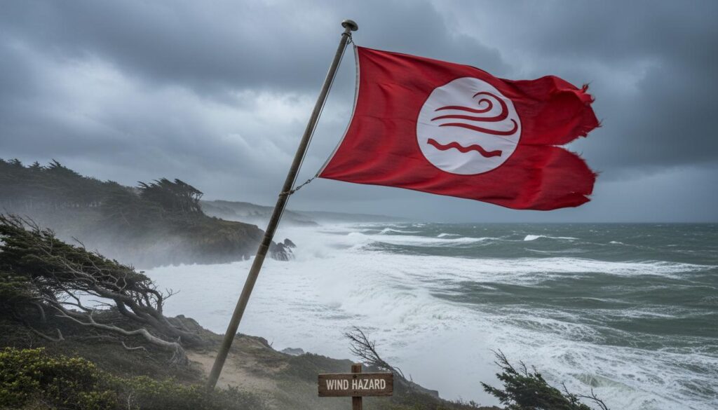
What a Wind Warning Means in Canada
In Canada, a wind warning is a formal alert issued by Environment and Climate Change Canada (ECCC) when winds are expected to reach levels that can cause damage or pose a safety risk. It’s not just “a bit breezy.” These warnings are based on criteria that vary by region, but the general national benchmark is sustained winds around 70 km/h or stronger, and/or wind gusts around 90 km/h or higher. That threshold is high on purpose: by the time a wind warning appears, unsecured items can become projectiles, weaker trees start failing, and driving becomes tricky, especially for high-profile vehicles.
Why the regional differences? Canada’s geography stretches from the Pacific to the Atlantic to the Arctic, and wind behaves differently in each setting. Mountain valleys can accelerate winds dramatically. Coastlines see storm and hurricane remnants. Prairie provinces get powerful pressure gradients and chinook events. ECCC calibrates thresholds so alerts balance usefulness with accuracy. In short, a wind warning in Halifax, Calgary, or Whitehorse reflects local wind climatology and impacts, but the headline is the same: take protective action.
It helps to distinguish a wind warning from other messaging you might see. A Special Weather Statement is an early heads-up about potentially impactful weather, often when confidence is lower or the event looks marginal. A weather watch means conditions are favourable for a hazardous event (more common for severe thunderstorms and tornadoes). A warning means the event is imminent or occurring. In the case of wind, ECCC generally goes straight to “warning” when threshold criteria are expected to be met within the warning area.
How Environment and Climate Change Canada Issues Alerts
Canada’s weather alerting system is intentionally multi-channel so you can get the message quickly and from more than one source. ECCC posts alerts on weather.gc.ca, pushes notifications through the WeatherCAN app, updates the interactive weather alert map, and provides data feeds (RSS and CAP) that power many third-party apps and municipal alert systems. Traditional media—radio, TV, and Canada’s weather broadcasters—also carry these alerts, and meteorologists often add context and timing.
Do wind warnings trigger those loud Wireless Public Alerts (Alert Ready) on your phone? Usually not. In most provinces and territories, tornado warnings, some extreme tornado risk thunderstorm warnings, and certain civil emergencies trigger a wireless alert. A standard wind warning does not always meet that bar, even though it can still be dangerous and disruptive. That’s why it’s smart to install the WeatherCAN app, follow your local ECCC office on social media, or subscribe to alert services your municipality uses (for example, Alertable or Voyent Alert). If you work or travel on the water, get familiar with marine weather channels on VHF and the Canadian Coast Guard’s broadcast schedule.
When a wind warning is updated or upgraded—for instance, if gusts are now expected to reach 110 km/h—you’ll often see the change first on WeatherCAN and weather.gc.ca. Forecast discussions and radar/satellite loops can add extra detail if you like to go deeper. If you prefer short and sweet, check the alert headline, the expected peak wind speeds, the timing window, and the plain-language impacts section.
Wind Terminology, Decoded
Forecast language can sound technical until you match it to what you feel outdoors. Here’s how to read the numbers.
Sustained wind is the average wind speed over a period (often one or two minutes in Canadian reporting). Gusts are brief surges above the sustained speed, typically lasting a few seconds. A forecast of “sustained 60 km/h, gusting to 90” means you’ll feel a steady push of 60, with sudden, stronger hits to 90—enough to shift your footing and make a loose fence rattle.
Units matter. Canada uses km/h for wind on land. Marine forecasts use knots. One knot is 1.852 km/h. If you see a gale warning at 35 to 47 knots, that’s roughly 65 to 87 km/h. The U.S. often uses miles per hour (mph); 60 mph is about 97 km/h. Comparing across sources? Convert carefully so you don’t underestimate the risk.
Gust factors vary with terrain. Open prairie or lake surfaces can sustain higher speeds, but urban canyons can accelerate and funnel wind, causing surprising gusts between tall buildings. Hills and gaps can do the same; that’s why some communities see “local gusts” far above surrounding areas. Also note that elevated locations—bridges, ridge tops, high floors of towers—experience higher wind speeds than sheltered ground-level spots.
You may also see the Beaufort scale discussed in nautical circles. It links wind speed to observable conditions, like whitecaps or tree movement. While it’s a helpful mental model, modern warnings rely on measured and modelled wind speeds rather than descriptive categories.
Regional Wind Patterns Across Canada
Canada’s wind stories are local. Recognizing the patterns where you live turns a generic forecast into a specific plan.
British Columbia and the Pacific Coast
Coastal storms rolling in from the Pacific often deliver powerful southwesterly winds, especially in the fall and winter. Strait of Georgia crossings can get gnarly fast; BC Ferries sometimes delays or cancels sailings during gale events. Fraser Valley outflow winds, driven by high-pressure air spilling from the Interior, can roar through the Lower Mainland with bitter chill and damaging gusts. In Squamish and Howe Sound, gap winds and katabatic flows are part of local life. Vancouver Island sees frequent wind warnings on its outer coast, and even inland regions like the Okanagan get hit by downslope winds that surprise newcomers who thought “valley” meant calm.
Prairie Provinces
Alberta, Saskatchewan, and Manitoba are wind country. Strong pressure gradients sweep across the open landscape with little to slow them. Winter clippers and spring storms can drive sustained winds that kick up blowing snow and dust, sometimes reducing visibility to near-zero on rural highways. Chinook winds east of the Rockies are the headline-makers: they warm temperatures dramatically but can also descend as violent downslope winds. Southern Alberta has a long record of high gusts toppling transport trucks and damaging roofs during these events.
Ontario and Quebec
Great Lakes storms in autumn and winter can produce formidable wind fields. As lows deepen over the lakes, shoreline communities get buffeted, and fetch-driven waves hammer beaches and breakwalls. Inland, winds mix down behind cold fronts, bringing tree damage and wide power outages. Thunderstorm season adds a different kind of risk: derechos—fast-moving lines of severe storms—can produce destructive straight-line winds over long corridors. The May 2022 derecho carved a path from southwestern Ontario through the Ottawa Valley into Quebec, with gusts well above 100 km/h, bringing down thousands of trees and crippling infrastructure for days.
Montreal and Quebec City see intense winds funnelling along the St. Lawrence valley, especially with strong pressure gradients. Bridges across the St. Lawrence and Ottawa rivers can be particularly exposed; drivers feel that shove as soon as they clear the wind shadow of the abutments.
Atlantic Canada
Nor’easters, post-tropical cyclones, and winter storms shape the wind climate here. Nova Scotia, New Brunswick, Prince Edward Island, and Newfoundland and Labrador all see frequent wind warnings. Cape Breton’s infamous les suêtes are mountain-wave winds that descend the leeward slopes with ferocity; local gusts over 150 km/h aren’t unheard of. In southwestern Newfoundland, the Wreckhouse winds—also a mountain-wave effect—are notorious for overturning high-sided vehicles; the term “Wreckhouse wind” has entered local language as shorthand for extreme gusts.
Confederation Bridge, which links PEI to New Brunswick, sometimes restricts or closes to certain classes of vehicles during high winds. If you’re planning a crossing, always check current restrictions; it’s a quintessential Atlantic Canadian example of wind-aware travel planning.
North and Arctic
In Yukon, Northwest Territories, and Nunavut, wind is often paired with cold and snow. Blowing snow warnings and blizzard warnings frequently accompany strong wind events. While the temperature might not change dramatically during a wind warning up north, visibility and frostbite risk can become life-threatening fast. Open tundra allows winds to maintain strength over long distances, and communities depend on local knowledge to judge safe travel windows between settlements.
What Strong Winds Actually Do: Impacts You’ll Feel
It’s tempting to think of wind as noise—trees waving, a bit of draft under the door. But impacts stack up quickly once speeds push into warning territory.
Trees are the first line of impact. Shallow-rooted species and trees with pre-existing rot or poor branching structures fail early. Frozen or saturated soils reduce anchoring strength, and urban trees fight a losing battle against compacted soils and restricted root zones. When limbs go, they take down lines, block intersections, and damage roofs and vehicles. After the May 2022 storm in Ontario and Quebec, some neighbourhoods looked like a beaver colony had gone to work overnight.
Structures rattle too. Older roofs with lifted shingles can peel. Garage doors—often the weakest part of a home’s exterior—can bow inward, allowing pressurization that makes roof failure more likely. Sheds and trampolines sail. On balconies, unsecured furniture becomes airborne. If you live in a condo tower, expect higher wind loads above the 10th floor; items that sit happily on a ground-level patio can vanish from a balcony during a high wind warning.
Transportation falters. High-profile vehicles—rental trucks, semi-trailers, RVs—are vulnerable to crosswinds, especially on bridges and exposed stretches of highway. Ferries cancel sailings on the Pacific coast and in the Maritimes. Pearson, Vancouver, and Halifax airports see waves of delays when crosswinds challenge runway operations. On rural roads, blowing snow or dust can reduce visibility to zero near open fields, while in cities, debris accumulates in traffic lanes and at intersections.
Water amplifies it all. Strong onshore winds pile water against lake and ocean shorelines. On the Great Lakes, storm surge combined with waves can lead to shoreline flooding. River valleys aligned with the wind can channel gusts and create standing wave conditions hazardous to paddlers and small craft.
Before a Wind Warning: How to Prepare
Wind preparedness isn’t complicated, but it pays to be systematic. Do a few things every windy season, and add specific steps when a warning appears.
Seasonal and Ongoing Prep
Start with your roof, trees, and the parts of your home that face wind first. If your roof is due for replacement, choose shingles or a roofing system designed and tested for higher wind resistance, and ensure proper installation per Canadian standards and manufacturer instructions. Ask about fastener patterns for high-wind regions and whether your warranty requires proof of professional installation. Consider reinforcing garage doors with bracing kits or upgrading to a wind-rated model, especially in storm-prone regions.
Trees deserve professional attention. Hire an ISA-certified arborist for structural pruning, removal of deadwood, and assessment of defects. Proper pruning can reduce the sail effect without hacking trees into hazards. If you plant new trees, choose species known for wind firmness in your region and give them good rooting conditions from the start. Keep a buffer of at least a few metres between mature trees and critical structures if you have that luxury; in older neighbourhoods, focus on health and maintenance.
Secure what you can. Anchor sheds and pergolas. Replace loose fence posts and consider designs with gaps to allow air to pass through. Install latches for gates that won’t pop open and slam repeatedly in gusts. If you live in a high-rise, invest in heavy planters and balcony storage with proper anchoring solutions allowed by your building rules. Ask your condo board or property manager for guidance; many high-rises have wind advisories for residents on upper floors.
Build a 72-hour emergency kit following Government of Canada guidance. Include water, shelf-stable food, medications, flashlights, a battery-powered or crank radio, power banks for phones, a small first-aid kit, and cash in small bills. Power outages are common in wind events, so think about non-perishable foods you’ll actually eat and a safe way to heat or prepare them if the stove is electric.
When a Wind Warning Is Issued
Once ECCC posts a wind warning for your area, tighten up the details. Walk your property. Stow or tie down patio furniture, barbecues (disconnect the propane), recycling bins, yard tools, ladders, and planters. Park vehicles away from big trees or anything that could topple. If your street is lined with older trees, consider moving your car to a clearer side street or a parking garage.
Inside, charge devices and power banks. Freeze ice packs and fill water pitchers if you’re on a private well that relies on electricity. Set your fridge and freezer to colder settings ahead of an outage. Have a cooler ready for transferring essential perishables if necessary. If you run a home business, back up files and stage a UPS for your modem/routers so you can stay online through brief outages.
Talk to the people around you. Check on neighbours who might need help moving patio items or shutting storm windows. If you live in a rental or condo, ask building management how they communicate about power, water, and elevator issues during outages. If your kids are in school or daycare, review their early-dismissal policies for severe weather. Keep the WeatherCAN app open and notifications on; review the timing and peak gusts expected so you know when to be indoors.
During a Wind Event: Safety First, Then Everything Else
Once the wind arrives, the priority is simple: avoid exposure and stay out of the debris path. Most injuries in high wind are caused by falling branches, flying objects, and power line incidents, not by buildings collapsing.
Indoors, move away from large, windward windows. Close interior doors to reduce the risk of pressure differences amplifying damage if a window does fail. Avoid using candles if the power goes out; battery lanterns are safer. If you must use a generator, never run it indoors, in a garage, or close to windows or vents. Carbon monoxide kills quietly.
If you’re driving, ask yourself whether the trip is essential. If you must go, reduce speed, keep both hands on the wheel, and give extra space to transport trucks and buses. Anticipate strong crosswind gusts when you exit a sheltered area onto an open bridge or overpass. Do not stop on bridges to “wait it out.” If conditions deteriorate rapidly, pull well off the roadway in a safe place; don’t use hazard lights while moving, as that confuses other drivers about whether you’re stopped.
On foot, avoid standing under trees, near scaffolded construction sites, or beside unsecured hoarding and signage. In parks and greenbelts, delay the dog walk until after the peak wind window. Keep kids and pets away from creeks and shorelines—waves and flying spray hide debris and can knock people off balance.
If you see a downed power line, assume it’s energized and deadly. Stay at least 10 metres away (about the length of a city bus), keep others back, and call 911 and your local utility. Many Canadian utilities also have outage reporting apps; use them if it’s safe to do so. Never move a downed line yourself, and don’t drive over it.
After the Wind Warning: Clean-Up, Claims, and Getting Back to Normal
When the wind eases and it’s safe to step outside, slow down. The scene is often deceptive. Branches hung up in the canopy can fall minutes or hours later. Fences and roofs might be one gust away from failure.
Walk your property carefully. Take photos of all damage before moving anything. If you can make temporary repairs safely—tarping a small roof patch, boarding a broken window—do it to prevent further damage. Keep receipts for materials and labour; Canadian insurers expect and reimburse reasonable emergency measures taken to mitigate loss.
Call your insurer early. In most standard Canadian home insurance policies, wind damage is covered. Wind-driven rain may be covered if the wind first damages the building envelope (for example, shingles torn off) and water enters as a result. If rain simply blows in through an open or poorly sealed window without wind damage, coverage may be limited. Overland flooding from storm surge or lake levels is a different coverage category (often optional). Each policy is different; your broker or insurer can confirm specifics. Tenants should contact their renters insurance provider for contents coverage; the landlord’s policy covers the building but not your belongings.
Document conversations, keep a claim log, and don’t discard damaged items until the adjuster says it’s okay—unless they’re hazardous. If fallen trees are involved, be realistic about your skills and your saw. Chainsaw accidents are a post-storm epidemic. Hire an ISA-certified arborist for anything beyond basic small-limb cleanup, especially near lines or structures.
Food safety matters after an extended outage. Health Canada guidance is straightforward: a full freezer can keep food frozen for about 48 hours if unopened (24 hours if half full). The refrigerator will keep food cool for about 4 hours if the door stays closed. If perishable food has been above 4°C for more than two hours, it should be discarded, even if it looks and smells normal. When in doubt, throw it out; food-borne illness is not worth the gamble.
Building and Renovating for Wind Resilience in Canada
Preparedness is good. Designing for wind is better. Canada’s National Building Code (adopted and adapted by provinces and territories) includes region-specific wind loads based on historical and modelled data. Newer homes built to current codes generally perform better in high winds than older stock, but details still matter.
Consider strengthening the load path—the continuous chain that transfers forces from the roof, through walls, into the foundation. Roof-to-wall connections (hurricane clips or straps), adequate sheathing and fastener patterns, and reinforced gable ends help resist uplift and racking. In high-wind regions, talk to your contractor about best practices that often exceed bare-minimum code, especially for roof attachments and garage doors. Small dollar investments up front can prevent large losses later.
Windows and doors deserve attention. Quality installation is as important as the product itself; improper flashing and nailing allow wind-driven rain to wreak havoc even when glass doesn’t break. For homes in particularly windy microclimates—like coastal headlands or mountain gaps—consider products with higher performance ratings and consult local builders who know what lasts in your area.
Outbuildings and site features should be anchored, not just heavy. Sheds, carports, and pergolas need proper footings and fasteners. Fences with small gaps reduce the sail effect better than solid panels, and sturdy posts set deep in concrete hold up best. Satellite dishes, rooftop HVAC units, and solar panels should be installed to manufacturer wind specifications, with periodic inspection.
Wind Warnings and the Marine Environment
On the water, wind is everything. If you boat, fish, or paddle in Canada—on the Great Lakes, the St. Lawrence, or the coastal oceans—pay close attention to marine forecasts. Wind over open water has room to build waves, and even moderate winds can create dangerous conditions quickly.
Marine warnings differ slightly from land alerts, and they’re based on knots:
| Alert Type | Land or Marine | Typical Criteria | Common In | Notes |
|---|---|---|---|---|
| Strong Wind Warning | Marine | 20–33 knots (approx. 37–61 km/h) | All Canadian waters | Small craft should use caution; waves become steep. |
| Gale Warning | Marine | 34–47 knots (approx. 63–87 km/h) | Great Lakes & oceans | Serious conditions, common with strong lows. |
| Storm Warning | Marine | 48–63 knots (approx. 89–117 km/h) | Coastal & large lakes | Hazardous; recreational boating should not be underway. |
| Hurricane Force Wind Warning | Marine | 64+ knots (approx. 118+ km/h) | Atlantic & Pacific | Associated with powerful cyclones or remnants. |
Before launching, check ECCC marine forecasts and the Nearshore Marine Forecasts for the Great Lakes. On VHF, monitor weather channels and notice updates to gale warnings. Plot safe harbours or lee shores ahead of time. Paddlers should be especially conservative; a 20-knot onshore wind on Lake Superior is a very different beast than a breezy day on a sheltered pond. Dress for immersion, carry a means of communication in a waterproof case, and be prepared to change plans or stay on shore entirely when a strong wind warning is in effect.
Business Continuity: Keeping Operations Running When the Wind Takes Out the Power
Small and mid-sized businesses often feel wind impacts quickly—no power means no point-of-sale, no refrigeration, no data access. A simple continuity plan makes a difference.
Start with power. Size a generator appropriately for your critical loads and install a transfer switch. Keep UPS units on servers and network hardware to allow controlled shutdowns. Test backup systems before storm season. If you rely on cloud services, ensure you have offline access to essential documents and a way to hotspot via cellular if wired internet is down.
Communications matter. Set a staff phone tree or group messaging protocol and decide who makes the call to close or shift to curbside-only service. Keep printed quick-reference guides for manual credit card processes if your payment provider supports them, and know whether your insurance covers food spoilage or business interruption after a wind-related outage.
Protect the exterior. Secure signage, patio furniture, and dumpster lids. If you have rooftop units, schedule periodic inspections to ensure anchors and flashing are sound. After a wind event, check for damage before reopening areas to the public.
The Meteorology Behind Wind Warnings: Why It Blows So Hard
Winds form because air moves from high pressure to low pressure, and the stronger the pressure gradient, the faster the air accelerates. Mid-latitude cyclones—the large weather systems that parade across Canada—are the main drivers of warning-level winds. When these lows deepen quickly (sometimes termed “bomb cyclones”), their pressure gradients tighten and winds surge, especially on their back (cold) side.
Fronts also play a role. Ahead of cold fronts, a low-level jet can scream just a few hundred metres above the ground. If a strong front passes and mixes that momentum downward, surface gusts can spike in minutes. That’s why you’ll hear forecasters talk about “mixing potential” and “downward momentum transfer.”
Topography is a force multiplier. Mountain waves form when strong winds cross a mountain barrier; air oscillates and can accelerate dramatically on the lee side, producing severe downslope winds like the les suêtes and Wreckhouse. Gaps and valleys funnel flow, squeezing wind to higher speeds. Urban canyons between towers can do something similar, generating localized gusts that surprise pedestrians and push cyclists sideways.
Thunderstorms add a different mechanic: downbursts. Rain-cooled air descends rapidly and, when it hits the ground, spreads out as powerful straight-line wind. Derechos are essentially long-lived, organized systems of storms with repeated downburst-driven wind fields. Their damage is often mistaken for tornadoes because debris lies in the same direction, but the cause is widespread straight-line wind.
Tools and Apps Canadians Can Use for Wind Awareness
Good information is half the battle. A short list of reliable tools keeps you one step ahead.
- WeatherCAN (ECCC’s official app): Real-time alerts, forecasts, radar, and satellite. Set multiple locations, including your cottage, your parents’ place, and your office.
- weather.gc.ca: The authoritative source for alerts and forecast discussions; the alert map gives a clear regional picture.
- Municipal alerting apps (e.g., Alertable, Voyent Alert): Many Canadian municipalities use these for local advisories, facility closures, and evacuation notices. They often rebroadcast ECCC alerts and add municipal instructions.
- Wind visualization tools (e.g., Windy, Ventusky): Great for seeing modelled wind fields and gusts. Use them to complement, not replace, ECCC forecasts.
- Marine: VHF weather channels, the Canadian Coast Guard’s MCTS broadcasts, and marine.weather.gc.ca for gale and storm warnings.
- Utility outage maps: Hydro-Québec, BC Hydro, Hydro One, SaskPower, Nova Scotia Power, and others show where outages exist and estimated restoration times.
Myths and Common Mistakes About Wind Warnings
Wind inspires folklore. Some of it is wrong enough to be dangerous.
“Open a window to equalize pressure.” Don’t. Opening windows increases the chance of debris entering and creates internal pressure paths that can worsen damage. Keep windows closed and locked.
“Tape your windows.” Tape doesn’t prevent glass from breaking. It adds zero meaningful strength and can produce larger, more dangerous shards. If you’re concerned about flying glass, move away from windows or use properly rated protective film installed by a professional—not a last-minute DIY with duct tape.
“It’s just wind; I’ll be fine on the pier.” Strong onshore winds and waves sweep people off rocks and breakwalls every year. Stay back from the water’s edge during gales, especially on the Great Lakes and Atlantic coast.
“Generators are fine in the garage with the door open.” They are not. Carbon monoxide builds fast and can drift into the home. Operate generators outdoors, well away from openings, with the exhaust directed downwind and a working CO alarm inside.
“Wireless emergency alerts will warn me if it’s bad.” Not always. A standard wind warning usually won’t trigger a cellphone alert. You need to monitor forecasts and alerts proactively.
Special Considerations: Seniors, High-Rises, Farms, and Construction Sites
One size doesn’t fit all. Different settings face different wind risks.
For seniors and people with limited mobility, the top risk is falling branches or tripping on debris when trying to secure outdoor items at the last minute. Move patio items earlier and ask neighbours or family for help. Keep flashlights with large, easy switches and pre-set contacts on your phone.
High-rise residents should be extra cautious with balcony items. Even small objects become missiles at height. Buildings may have rules for balcony storage; follow them. During prolonged outages, elevators may be down—plan for water, medication, and a communications check-in with family.
Farms face unique exposure. Barn roofs and large doors take brunt forces; pre-storm, close and secure large doors, and move equipment under cover. Relocate animals from areas with tall, brittle trees if possible. For backup power to run waterers and ventilation, ensure transfer switches are properly installed and test-run generators well before a storm. Keep spare fuel stored safely.
Construction sites should follow provincial occupational health and safety regulations and manufacturer wind limits. Tower cranes, suspended loads, and scaffolding all have explicit maximum wind thresholds. Secure loose material and tools, brace or lower crane jibs for weather-vaning as per manufacturer guidance, and restrict access around hoardings and temporary fences that can fail under gusts.
Travel and Transportation: Real-World Canadian Examples
Exploring Canada means crossing bridges, riding ferries, and driving open highways—all wind-prone places. A few examples to plan around:
Confederation Bridge issues travel restrictions during high winds, sometimes closing to motorcycles and high-sided vehicles. Check bridge advisories before you set out. In British Columbia, BC Ferries often delays or cancels when strong wind warnings align with tide and wave conditions. On the Great Lakes, commercial vessels may shelter in port under gale warnings, and recreational boating should wait it out entirely.
On highways in southern Alberta and Saskatchewan, transport trucks are occasionally blown into ditches during chinook events. If your move or delivery depends on a high-profile vehicle, watch for wind forecasts and consider rerouting or rescheduling. In urban centres like Toronto, pedestrians and cyclists experience severe gusts near tall towers after frontal passages—consider alternate routes that avoid the worst wind canyons.
Quick-Action Timeline for a Wind Warning
| Timeframe | Actions |
|---|---|
| 48–24 hours before |
|
| 24–6 hours before |
|
| During peak winds |
|
| After winds subside |
|
Case Studies: Lessons from Recent Canadian Wind Events
Real outbreaks of wind tell the story better than any theory.
May 21, 2022, Ontario–Quebec derecho: A fast-moving line of severe thunderstorms produced destructive straight-line winds exceeding 120 km/h in places. The result: broad swaths of downed trees, extended power outages, and infrastructure damage across multiple cities. Lesson learned: summer wind threats aren’t only about tornadoes. Straight-line wind can be more widespread, and a “severe thunderstorm warning” can carry wind risks on par with a wind warning for damage potential.
Pacific fall storm cycles: Each autumn, a series of Pacific lows slam the British Columbia coast. For coastal residents, the routine is almost ritual—bring in the patio set, plan errands between systems, and get used to the sound of trees flexing. Ferries adapt; drivers pick inland routes; power utilities stage crews ahead of the first big blow. Lesson learned: seasonal readiness turns what could be chaos into an inconvenience.
Wreckhouse winds, Newfoundland and Labrador: These localized mountain-wave winds have overturned transport trucks and regularly force travel advisories. Lesson learned: microclimates matter. A general forecast can look tame while a local hotspot experiences extreme gusts. When you see a localized wind warning or advisory for a specific corridor, take it at face value.
Frequently Overlooked Details That Make a Big Difference
A few small choices amplify resilience.
Number one: power banks and a small battery hub. Fully charged, they keep phones, headlamps, and a modem running for hours. Number two: anchor points. A few eye-bolts on a deck or fence post let you secure items quickly with straps. Number three: neighbour networks. A five-minute chat before storm season means you know who needs help and who can lend a ladder. Number four: a labelled breaker panel. If an exterior outlet shorts in the wind and rain, you don’t want to guess which breaker to flip in the dark.
Understanding How Wind Warnings Interact with Other Alerts
High wind rarely shows up alone. It often travels with rain, snow, or thunderstorms. You might see a wind warning alongside a rainfall warning, winter storm warning, snow squall warning, or freezing rain warning. Each adds its own hazards: saturated soils weaken trees, snow loads amplify damage if branches break, and freezing rain adds weight while the wind does the rest. Treat combined alerts as multiplicative, not additive.
Blizzard warnings are separate and have specific criteria: strong winds, blowing snow, and very low visibility for several hours. If you’re in Canada’s North or the Prairies, you’ll see these more often than standalone wind warnings in winter. The behaviour change is similar: restrict travel, stock essentials, and check on neighbours.
Where to Get Trustworthy Local Guidance
In addition to ECCC, lean on local expertise. Municipal social media accounts and websites provide information on road closures, transit disruptions, and facility openings (like warming centres). Provincial transportation departments update highway conditions and bridge restrictions. Provincial utilities report outages and safety guidance, often with estimated restoration times. Parks Canada posts trail and backcountry advisories; if you were planning a ridge-top hike in the Rockies, a wind warning is a reliable signal to choose a valley trail or delay the trip.
Checklist: Make Your Household Wind-Ready
- Download WeatherCAN; enable notifications for home, work, and relatives’ addresses.
- Build a 72-hour kit with water, food, lights, radio, power banks, medications, and cash.
- Have a plan to secure outdoor items quickly; keep straps or bungee cords handy.
- Schedule roof, tree, and exterior maintenance before storm season.
- Know where you will park during wind events to avoid large trees and loose signage.
- Prepare for outages: cold-packs in freezer, coolers ready, CO alarms working.
- Review insurance coverages for wind, wind-driven rain, sewer backup, and overland water.
- Create a neighbourhood contact list and a simple check-in plan.
FAQs: Wind Warnings in Canada
What triggers a wind warning in Canada?
ECCC issues a wind warning when winds are expected to meet region-specific criteria that typically align with sustained speeds around 70 km/h and/or gusts of about 90 km/h or higher. Local geography, season, and typical impacts influence the exact threshold. The warning means damaging winds are likely—secure property and plan to limit exposure during the peak.
Is a “wind advisory” the same as a wind warning?
In Canada, ECCC uses “wind warning” rather than “wind advisory” for impactful wind on land. You might see a Special Weather Statement ahead of time for windy conditions that don’t yet meet warning criteria. Marine forecasts use “Strong Wind Warning” at lower thresholds (20–33 knots) suitable for mariners.
Do I get a loud Wireless Public Alert for a wind warning?
Generally, no. Wireless Public Alerts (Alert Ready) on your phone are reserved for the most urgent threats, such as tornado warnings and certain civil emergencies. A standard wind warning doesn’t always trigger a wireless alert. Use the WeatherCAN app and local alerting systems for timely updates.
What’s the difference between sustained wind and gusts?
Sustained wind is the average speed over a short period—what you feel as the steady push. Gusts are brief spikes above that average. Gusts often cause the most noticeable damage (branches breaking, windows rattling) and driving challenges, especially when they hit suddenly in exposed areas.
Why do high-rises feel windier? Are balconies safe?
Wind speeds increase with height above ground and can accelerate between towers. Upper-floor balconies experience stronger gusts than ground-level patios. Keep balconies clear or use heavy, anchored furnishings allowed by your building rules. During a wind warning, remove loose items; even small objects can become dangerous projectiles.
How should I drive during a wind warning?
Only drive if necessary. Reduce speed, hold the wheel firmly, and anticipate strong crosswinds when you exit wind shadows onto bridges or open stretches. Give extra space to transport trucks and buses. If conditions escalate, pull off safely and wait. Avoid stopping on bridges or directly under large trees.
Are ferries and bridges affected by wind warnings?
Yes. BC Ferries, Marine Atlantic, and other operators often delay or cancel sailings during strong winds. Confederation Bridge may restrict or close to certain vehicles when winds are high. Check official advisories before travelling; wind restrictions are common in Canadian coastal and strait crossings.
Does home insurance in Canada cover wind damage?
Typically, yes. Most standard home insurance policies cover wind damage. Wind-driven rain may be covered if wind first causes damage that allows water entry. Overland water (flooding from lakes/rivers) or storm surge usually requires optional coverage. Check your policy or speak with your broker to clarify details, deductibles, and exclusions.
What about food in the fridge and freezer after a power outage?
Keep the fridge and freezer doors closed. A full freezer keeps food frozen for about 48 hours (24 hours if half full). The fridge stays cold about 4 hours. If perishable food has been above 4°C for more than two hours, discard it. When unsure, throw it out—Food safety rules from Health Canada prioritize caution.
How do marine wind warnings differ from land wind warnings?
Marine warnings use knots and include categories such as Strong Wind Warning (20–33 kt), Gale Warning (34–47 kt), Storm Warning (48–63 kt), and Hurricane Force Wind Warning (64+ kt). These thresholds are tuned to vessel safety. On land, “wind warning” is used for damaging winds usually at higher speeds (in km/h), with thresholds varying by region.
What are Wreckhouse winds and les suêtes?
They are powerful downslope wind phenomena caused by mountain waves. Wreckhouse winds occur in southwestern Newfoundland, while les suêtes affect Cape Breton Island in Nova Scotia. Both can produce extreme localized gusts that exceed broader regional forecasts, prompting targeted travel advisories and, at times, closures.
Can I predict power outages from a wind warning?
You can’t predict exact locations, but risk rises with higher gust forecasts, saturated or frozen soils, leafy trees (in the growing season), and storm timing (overnight storms delay response). Utilities often stage crews when a wind warning aligns with vulnerable conditions. Assume an outage is possible and prepare accordingly.
What should apartment dwellers do differently?
Focus on balcony safety and outage preparedness. Remove or secure loose items, keep power banks charged, and plan for elevator outages. Know your building’s communication channels for water and heating issues. If parking underground is an option, use it to avoid falling branches and debris.
Are there legal or regulatory standards for wind-resistant construction in Canada?
Yes. Provincial and territorial building codes, based on the National Building Code of Canada, include wind load requirements that vary by location. Product standards (e.g., for roofing) and manufacturer installation instructions also specify wind performance. For major projects or retrofits, consult qualified professionals familiar with your region’s code requirements and wind climate.
What’s the smartest single thing I can do when a wind warning is issued?
Secure or bring inside anything the wind can move, before it arrives. Most preventable damage—broken windows from flying debris, dented vehicles, torn fences—starts with unsecured outdoor items. Ten minutes in daylight can save hours of cleanup and hundreds of dollars in repairs.